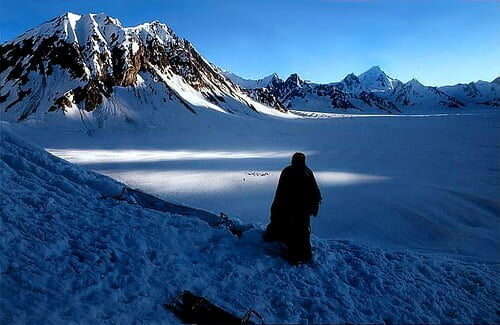
Ever since childhood as far as my knowledge is concerned Pakistan Army controlled Siachen Glacier but on the wikipedia the information is entirely different The Indian Forces on the world’s highest battle field Siachen ? Still Pakistan Army holds the control over Siachen
Courtesy of Wikipedia :-
The Siachen Glacier is located in the eastern Karakoram range in the Himalaya Mountains at about 35.5°N 77.0°E, just east of the Line of Control between India-Pakistan. India controls all of the Siachen Glacier itself, including all tributary glaciers. At 70 km (43 mi) long, it is the longest glacier in the Karakoram and second-longest in the world’s non-polar areas.[4] It falls from an altitude of 5,753 m (18,875 ft) above sea level at its head at Indira Col on the China border down to 3,620 m (11,875 ft) at its terminus.
” Indian army checkposts are located on the Siachen glacier. The world’s highest battlefield is also located on the glacier at a height of 6,400 m above sea level.[5] GSM mobile service was launched in 2009 near the army base camp ”
They are no where close to Karakorum which is just aside of Siachen, even the position which is mentioned is wrong, this is right next to K2, which is in Pakistan, Indian Army controls The Saltoro Mountains in Himalaya Range on the Siachen Conflict this is what Wikipedia says :-
The Siachen Conflict, sometimes referred to as the Siachen War, is a military conflict between India and Pakistan over the disputed Siachen Glacier region in Kashmir. A cease-fire went into effect in 2003. The conflict began in 1984 with India’s successful Operation Meghdoot during which it wrested control of the Siachen Glacier from Pakistan and forced the Pakistanis to retreat west of the Saltoro Ridge. India has established control over all of the 70 kilometres (43 mi) long Siachen Glacier and all of its tributary glaciers, as well as the three main passes of the Saltoro Ridge immediately west of the glacier—Sia La, Bilafond La, and Gyong La. Pakistan controls the glacial valleys immediately west of the Saltoro Ridge.[3][4] According to TIME magazine, India gained more than 1,000 square miles (3,000 km2) of territory because of its military operations in Siachen.[5] ?
Does Indian Army controls it or Pak Army? now read this by wikipedia
In 1957 Pakistan permitted a British expedition under Eric Shipton to approach the Siachen through the Bilafond La, and recce Saltoro Kangri.[9] Five years later a Japanese-Pakistani expedition put two Japanese and a Pakistani Army climber on top of Saltoro Kangri.[10] These were early moves in this particular game of oropolitics.
The United States Defense Mapping Agency (now National Geospatial-Intelligence Agency) began in about 1967 to show, with no legal or historical justification or any boundary documentation, an international boundary on their Tactical Pilotage Charts available to the public and pilots as proceeding from NJ9842 east-northeast to the Karakoram Pass at 5,534 m (18,136 ft) on the China border.[11] Numerous governmental and private cartographers and atlas producers followed suit. This resulted in the US cartographically “awarding” the entire 5,000 square kilometers (1,900 sq mi) of the Siachen-Saltoro area to Pakistan.
If the above statement is true from climbers till USDMA than Siachen-Satoro is the area of Pakistan. everyone knows Karakoram Pass is in Pakistan which links it with China and I been there myself, so I don’t need false justification by Wikipedia, In one of the movie they have shown Northern Himalaya , Pakistan and the army Base camp ” The Vertical Limits “
I been little confused about it that’s why sharing with you all, it is divided in between Pakistan , China and India but the Army Base Camp which is one of the highest in the world is Pakistan’s not indian.
Still I ask the visitors , Who holds the control of the third pole ?


