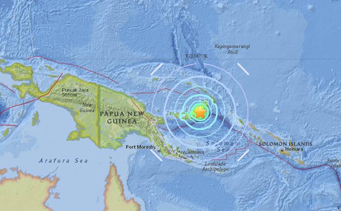
A magnitude 6.9 earthquake has hit off the coast of Papua New Guinea, triggering a tsunami threat message from the Pacific Tsunami Warning Center.
| Magnitudeuncertainty | 6.9 mww± 0.1 |
|---|---|
| Locationuncertainty | 5.475°S 151.442°E± 7.4 km |
| Depthuncertainty | 35.0 km± 1.9 |
| Origin Time | |
| Number of Stations | – |
| Number of Phases | 149 |
| Minimum Distance | 590.7 km (5.31°) |
| Travel Time Residual | 1.23 s |
| Azimuthal Gap | 25° |
| FE Region | NEW BRITAIN REGION, PAPUA NEW GUINEA (192) |
| Review Status | REVIEWED |
| Catalog | US (us1000db40) |
| Location Source | US3 |
| Magnitude Source | US3 |
| Contributor | US3 |
Magnitude 6.9 quake off Papua New Guinea triggers tsunami threat message
Papua New Guinea is located on the Pacific Ring of Fire, the most geologically active area in the world.
More than 90 per cent of earthquakes occur here, as well as 22 or the 25 biggest volcanic eruptions in history.
The volatility on the Pacific Ring of Fire over the past month or so has increased fears for the Big One: a major earthquake in a highly-populated area on the US west coast or in Japan.
And countries across the blog stretching from Chile in South America to New Zealand are preparing for more chaos and possible aftershocks and tremors after weeks of eruptions and quakes.


