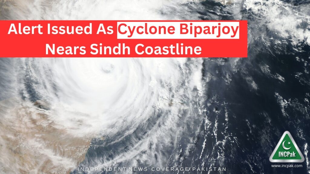
The National Disaster and Management Authority (NDMA) has issued a Cyclone Biparjoy gains strength and nears Sindh’s coastline. According to the details, Cyclone Biparjoy has turned into an extremely Severe Cyclonic Storm (ESCS) that will likely affect Sindh’s coastal areas on 12 June 2023 (Tuesday).

The NDMA has stated that Cyclone Biparjoy may intensify in the next 24 hours and likely affect the south and south-eastern parts of Sindh. The cyclone may cause strong winds, torrential rains and floods in coastal areas of the province.
The concerned authorities, including NDMA, Pakistan Meteorological Department (PMD), Provincial Disaster Management Authority (PDMA) Sindh and Balochistan, Pakistan Navy, Pakistan Maritime Security Authority (PMSA), Pakistan Coast Guards (PCG) are issuing advisories and guidelines to all stakeholders to take precautionary measures.
PMD Latest Update on Cyclone Biparjoy Nearing Sindh
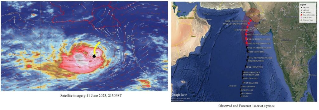
The Pakistan Meteorological Department (PMD) in an update said that Extremely Severe Cyclonic Storm (ESCS) “ BIPARJOY” over east-central Arabian Sea has moved further northward during last 12 hours and now lies near Latitude 18.7°N & Longitude 67.8°E at a distance of about 690km south of Karachi, 670km south of Thatta & 720km southeast of Ormara.
It added that Maximum sustained surface winds are 180-200 Km/hour gusts 220 Km/hour around the system center and sea conditions being phenomenal around the system canter with maximum wave height 35-40 feet.
Furthermore, the PMD said that the favorable environmental conditions (sea surface temperature of 30-32°C, low vertical wind shear & upper-level divergence) are supporting the system to maintain its severity.
It said that under the existing upper-level steering winds, the ESCS “BIPARJOY” is most likely to track further Northward until 14 June morning, then recurve Northeastward and cross between Keti Bandar (Southeast Sindh) and Indian Gujarat coast on 15 June afternoon as a Very Severe Cyclonic Storm (VSCS).
PMD’s cyclone warning center, Karachi is continuously monitoring the system and will issue update accordingly.

Possible Impacts:
- With its probable approach to the southeast Sindh coast, widespread wind-dust/thunderstorm rain with some very heavy/extremely heavy falls accompanied with squally winds of 80-100Km/hour likely in Thatta, Sujawal, Badin, Tharparker & Umerkot districts during 13-17 June.
- Dust/thunderstorm-rain with few heavy falls & accompanied with squally winds of 60-80 Km/hour likely in Karachi, Hyderabad, Tando Muhammad Khan, Tando Allayar, Mirpurkhas districts from 13/14 June -16 June.
- Squally (high intensity) winds may cause damage to loose & vulnerable structures (Kutcha houses).
- Storm surge of 3-3.5 meters (8-12 feet) expected at the land falling point (Keti Bandar and around).
- Fishermen are advised not to venture in open sea till the system is over by 17 June, as the Arabian Sea conditions may get very rough/high accompanied with high tides along coast.
Read more: Sindh Govt to Pay Advance Salary, Pension Ahead of Eid ul Adha.
Follow INCPAK on Facebook / Twitter / Instagram for updates.


