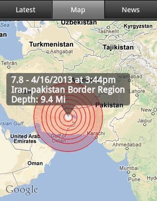
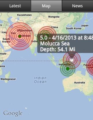
April 16 — An earthquake measuring 7.8 on the Richter scale jolted Iran-Pakistan border region at 1044 GMT on Tuesday, the U.S. Geological Survey said.The epicenter, with a depth of 15.20 km, was initially determined to be at 28.0559 degrees north latitude and 62.0804 degrees east longitude.Strong tremors of earthquake were felt in parts of Pakistan’s southern Sindh and southwest Balochistan provinces, while light tremors were also felt in eastern Punjab and northwest Khyber Pakhtunkhwa provinces Tuesday afternoon.
Tremors were also felt in India & Gulf States.Tall buildings shook in India’s capital New Delhi, sending people running into the streets, witnesses said. People also evacuated shaking buildings in Qatar and Dubai, residents said.
A powerful 6.3 magnitude quake struck close to Iran’s only nuclear power station on April 9, killing 37 people and injuring 850 as it destroyed homes and devastated two villages.Most of Iran’s nuclear-related facilities are located in central Iran or its west, including the Bushehr nuclear power plant on the Gulf coast. A U.S. Institute for Science and International Security map did not show any nuclear-linked facilities in southeastern Iran close to Pakistan.
Updates : A magnitude 7.8 earthquake has struck southeastern Iran near the border with Pakistan, reportedly killing at least 40 people with casualties expected to rise, according to the Iranian news agency FARS. The US Geological Survey said on Tuesday that the epicentre of the quake was 86km southeast of Khash, Iran. An Iranian government official said on Tuesday he expected hundreds of deaths from the earthquake. “It was the biggest earthquake in Iran in 40 years and we are expecting hundreds of dead,” said the official, who spoke on condition of anonymity.
The world stays in peace and Allah save us all.
