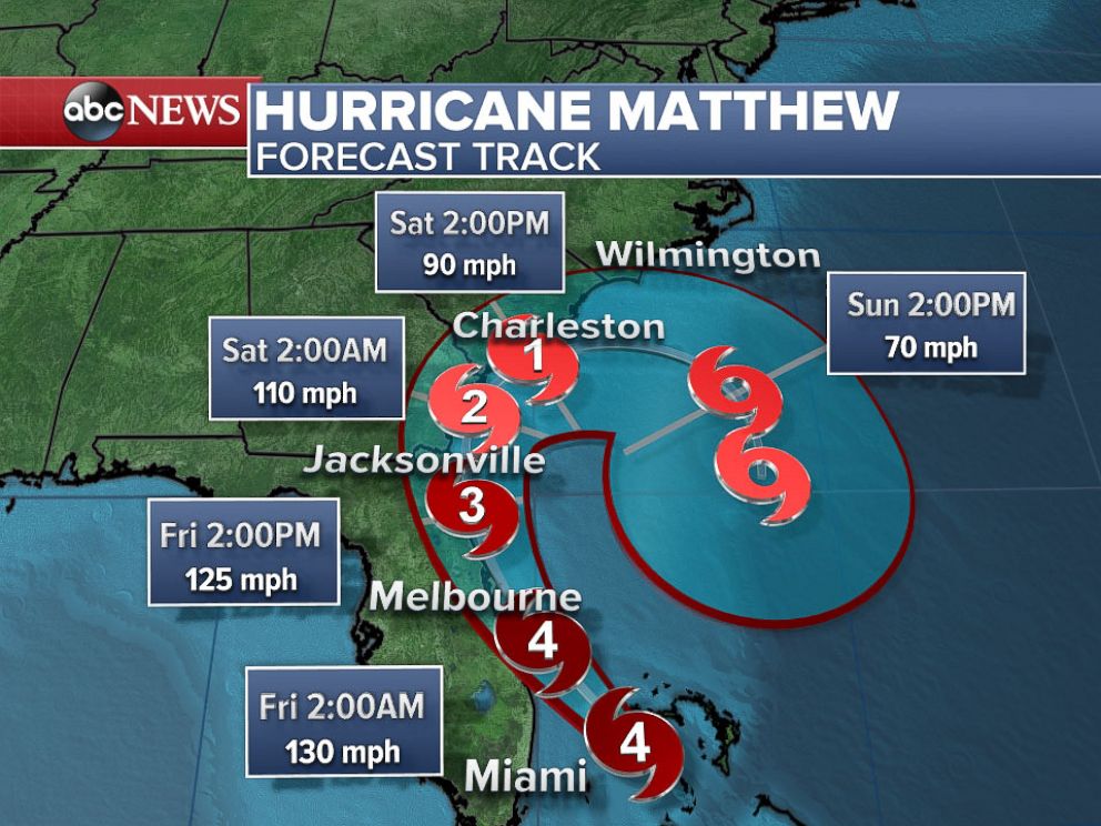
Hurricane Matthew – Early Friday, the storm weakened to a Category 3 storm, but still packed dangerous winds of 120 mph that could threaten land if the storm drifts only slightly closer to shore. The National Hurricane Center reported that the hurricane’s center was “hugging the coast of Central Florida” — moving north-northwest at 12 mph — as it took aim at the northern part of the state and then onto Georgia and South Carolina.
Hurricane Matthew Drives Storm Surge Into Northeast Florida; Hurricane Warning Extended to North Carolina; Dangerous Flood Threat in Carolinas, Georgia.
The potential for a destructive storm surge, coupled with up to 15 inches of rain expected in isolated areas, has officials fearing catastrophic flooding.
Hurricane Matthew
Rick Knabb, director of the National Hurricane Center, told “Good Morning America” today, “This is a big major hurricane that is just offshore and it is fully capable of producing life-threatening storm surge.”
“If you are in an area that emergency managers told you to evacuate and they’re telling you to go, you absolutely have to go now,” Knabb said. “Your life could depend on it.”
“We know from hurricane history that water takes nine out of ten lives in landfall,” Knabb said. “Matthew is going to write some history. The key here is you don’t want to be a part of it. I don’t want to be writing up a report … [on] fatalities and you’re one of them.”
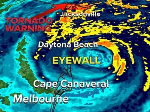
Satellite and radar imagery show the eye of Matthew marching north-northwest roughly paralleling the northeast Florida coast. The center of Matthew has gotten to within 25-30 miles of the Florida coast since early Friday morning, but that has been close enough to bring the western eyewall over areas around and just north of Cape Canaveral.


